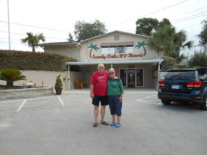
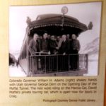
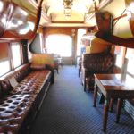
We were heading for Davenport, IA next. But our central propane heating system quit working. We figured that the subsequent destination – Springfield, IL – would offer more opportunity for mobile repair. So we made it to Illinois State Fairgrounds seven hours later and met a wonderful couple who were the caretakers every year. They not only fixed us up with a nice spot but called the local guy who could “fix anything.” We settled in. Suddenly the heating system was working fine!
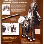
There was certainly plenty to see. And it wasn’t all Lincoln stuff. That weekend at the fairground featured a Junior Horse Show, which we planned to take in. Even better, the following weekend included an all-breed dog show. We contacted our dear friend, Michele Kasten, who lives about 90 miles south, to see if she’d be there. Not only was she coming to show her Schips, but she was setting up the fund raising booth for her non-profit, Midwest Schipperke Rescue (MSR). Michele is the Schipperke’s best friend; in addition to being both a champion breeder and rescuer, she is president of MSR, an officeer of the Greater St. Louis Schip Club, and actively on the board of more than a half dozen other clubs, including the Schipperke Club of America. She’s responsible for two members of our current rescue family, and all of our personal fund raising efforts earn money for MSR.
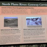
Our first stop downtown was the Visitors Center. We learned, to our relief, that most of the exhibits were state or privately funded and open. Only Lincoln’s home was closed by the Federal shutdown. Another nice thing we discovered was that our handicap sticker entitled us to free parking at all meters.
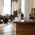
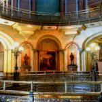
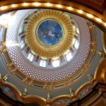
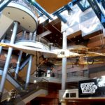
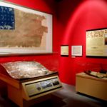
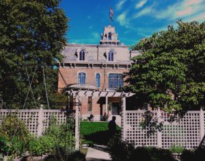
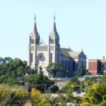
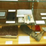
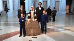
Just around the corner, we started out at the Lincoln Presidential Museum and the Presidential Library across the street. Upon entering the Museum, you’re confronted by a circular atrium the Lincoln family standing proudly in the center. Unfortunately, this is the point at which you had to put your camera away. Five entrances around the atrium led to a variety of exhibits. The two main galleries are designated with a replica of Abe’s boyhood home (we’ve been there!) and the façade of the White House. The third gallery is an outstanding multi-media presentation led by a live host and featuring holographic overlays on backgrounds of many experiences, beginning in the archives and morphing to a Civil War battlefield. Next is a replication of the Union Theater with another state-of-the-art presentation called Lincoln’s Eyes. Through them, we visualize key personal and political dramas confronting Lincoln throughout his life – especially slavery. The Treasures Gallery quickly rounds out one’s visit.
-
-
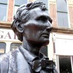
The sixteenth First Family
-
-
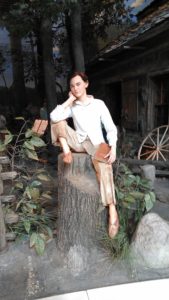
Abe as a boy in Kentucky
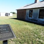
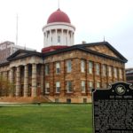
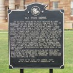
The Old State Capitol building was built between 1837 and 1840. It was the fifth capitol building in the state, but by the end of the Civil War, it was inadequate. The current Capitol, inaugurated in 1868, is the last – to date, at least.
-
-
The Old State Capitol
-
-
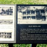
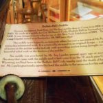
Description

Our favorite interpreter
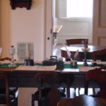
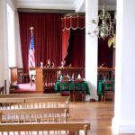
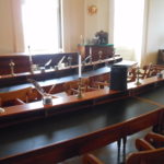
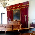
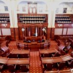
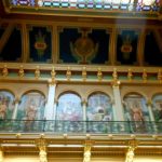
In its brief tenure, the Old State Capitol building saw Lincoln’s final service in the state legislature. He tried hundreds of cases in its Supreme Court, made his “House Divided” speech, and laid in state after his death before 75,000 mourners. We had a tour conducted by a woman who was a professional history interpreter; she rotated among state venues. She guided us through the governor’s suite, law library, legislative facilities and Supreme Court chambers. She’s pictured at right describing a grandfather’s clock in the Governor’s office.
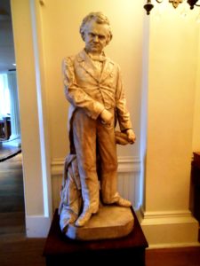
Stephen A. Douglas
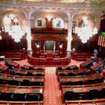
In the second floor rotunda, outside the House chamber, stands a statue of Stephen A. Douglas, Lincoln’s opposition both for Senate (Abe lost) and the Presidency (Abe won). The statue, by Leonard Volk, stands eight foot tall, almost three feet taller than its subject! Dubbed The Little Giant, Douglas, at 5’ 4”, he made up for lack of stature with brilliance and determination. It is fun to visualize his series of debates with Lincoln, a foot taller than he. Their debates in 1858 drew them to every one of the state’s seven Congressional districts, but only one of the locations has been preserved.
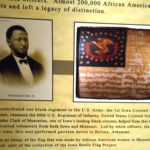
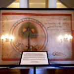 Another exhibit of note is a flag that’s identified as the Minnesota Constitutional State Flag. It was captured in 1861 in northern Missouri by by the 16th Illinois Infantry. It was the first of many such trophies, all of which were displayed in this building. In 1891, a Missourian clarified the flag’s origin and identified that it featured the palmetto tree and landscape of South Carolina, the first state to secede after Lincoln was elected president. This flag remains on exhibit in the Old State Capitol, while the others have been relocated to the state Military Museum. (Sound familiar? That’s where Iowa holds its own Civil War battle flags!)
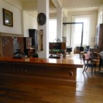
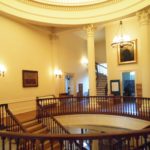
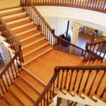
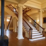
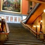
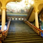
I can’t leave the Old Capitol without presenting the rotunda to you. The staircases are a treasure to behold.
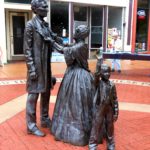
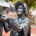
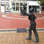
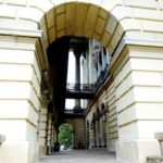
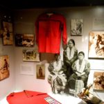
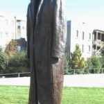
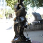
Directly across the street, where one finds the Lincoln-Herndon Law Offices, there’s a brick esplanade that features a wonderful statue of the Lincoln family and a young passer-by tipping his hat to them.
 When Lincoln opened his office in this building in 1843, his partner was Stephen Logan, a cousin of Mary Todd. A year later, they dissolved their partnership and Lincoln took on William Herndon as his junior partner. The firm of Lincoln-Herndon moved to another location in 1852 and survived until the President’s death in 1865. The lawyers occupied the third floor, while the state occupied the first and second with a post office and courtroom respectively. Today, the ground floor is its visitors center, It’s as far as we got.
Our next stops were two non-Lincoln (and non-governmental) exhibits. In my college days, I did extensive research and essaying on the era of the Pullman Strike and Illinois Governor John Philip Altgeld. Altgeld was the Progressive (some say anarchist) governor from 1893-1897. During his tenure, he pardoned three of the eight alleged leaders of the Haymarket Square Riot of 1888 — of the others, one had committed suicide and four had already been executed. He later refused to call in federal military support against the Pullman Strikes led by Eugene Debs in 1894. Debs is remembered for his efforts to revise labor laws, especially those involving child labor.
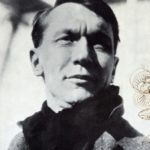
Lindsay was memorialized with a poem called The Eagle That is Forgotten, written by Vachel Lindsay. I was taken by the poem and could quote it for a long time. And I thought I knew a lot about its author . . . until Dot and I visited his home in Springfield, where our favorite interpreter — the young woman from the Old State House — led us through the history of Lindsay, his home and the considerably larger body of his work.
Nicholas Vachel Lindsay was well known for his artwork as well as his prodigious poetry. Born in 1879, he did well in high school and moved on to Hillman College to follow in his father’s medical footsteps. For three years, he excelled in literature and philosophy and failed pre-med and foreign languages. He moved on — first to the Chicago Art Institute and then to the New York School of Art, where his mentor advised him to concentrate more on his poetry than his art. The die was cast.
-
-
Nicholas Vachel Lindsay
-
-
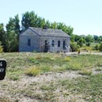
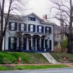
The Lindsay Home
-
-
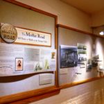
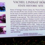
Story of the Site
Lindsay’s dominant calling for his entire life was as a traveling poet. From New York, he hopped a tramp steamer to Florida and then worked his way back to Illinois by bartering his poetry for meals. He set off on other sojourns and returned to Springfield on the eve of the Race Riots of 1908. Aghast that such a thing would happen not only in Lincoln’s home town but on the 100th anniversary of his birth, Lindsay gave a series of lectures on race, encouraging his fellow citizens to make the city a model of civility and decorum.
By 1913, having received recognition on both sides of the Atlantic and having several published volumes, his tramping days were over. He was the first American poet to be invited to speak at Oxford University. He courted Sara Teasdale, but she rejected him for a shoe manufacturer. Ten years later, he married a much younger Elizabeth Conner, and she bore two children. While he accepted numerous assignments, he always adopted the performance mode; he became known for actually singing, rather than reciting, some of his works.
Sickly from his youth, his health began a downward spiral in the late 1920s. While he still traveled to performances, he yearned for his beloved family and city. In desperation, he committed suicide in 1931. Today, the state is supplemented by the Vachel Lindsay Association, dedicated to preserving his heritage and furthering it by holding readings and exhibits in his home.
Again, no photos were allowed. I believe there are two dominant reasons: the fact that there is a great deal of copyrighted materials at these exhibits, and photos could be used by unsavory sorts to “case the joint.” For the pictures above of Lindsay and his home, I am indebted to Job Conger, creator of The Vachel Pages, who allows copying from his site.
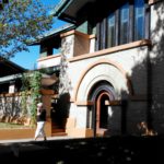
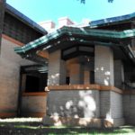
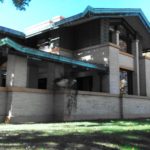
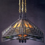
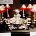
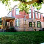
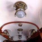
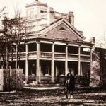
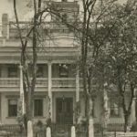
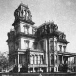
Wow. Maybe I can be briefer from here on. We moved next to the Dana Thomas House, one of the premier examples of Frank Lloyd Wright’s Prairie period. Designed in 1902, the 12,000 square foot dwelling was Wright’s first spare-no-expense commission. It was built for Susan Lawrence Dana (1862-1942), heiress to her father’s estate in 1901. Susan hired Wright to “remodel” the family’s Italianate homestead, but by the time it was finished, only one room of the original remained. The remodeled house was built on three levels, with an additional 13 interim levels. The architect worked diligently to keep eyes traveling outside, as was his wont. To help accomplish this, he developed the largest collection of furniture, art glass and accessories in any FLW property including the chandelier below.
Susan was a tragic figure who compensated by sharing her wealth with others. Her first husband died less than two decades after their marriage, and she suffered two miscarriages. Her second husband died within a year after their marriage, and her third union ended in divorce. She took on responsibility for her mother and her cousin Flora. Mother died suddenly while they were on an adventurous trip in 1905, and when Flora, who shared the house with her, died in 1928, Flora, Susan was left entirely alone.
Nonetheless, she continued in a whirlwind of social and political activities. But her finances suffered. Overextended, her wealth was tied up in nonconvertible assets, and she was forced to move from the house. By 1942, she became incompetent, and as soon as she was institutionalized, the gavel fell on her properties. Fortunately, the house was purchased by Charles C. Thomas, founder of the Thomas Register, who personally assured Wright that the house, while becoming the firm’s office, would be preserved. In 1981, the company sold the house to the state, and a second stroke of luck occurred. Jim Thompson, governor at the time and a strong advocate for Wright, filed a preservation bill that brought the house back to its original 1910 grandeur.
Not very brief, I know. But pictures were again verboten, as they have been in all the FLW properties we’ve toured. Trust us – it was exquisite, as were the anecdotes about its occupants.
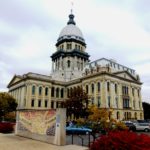
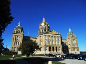
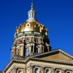
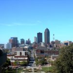
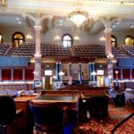
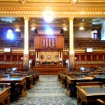
Our visit to the current State Capitol was right on the heels of our visit to the Iowa version in Des Moines, Here, I’ll spare you a lot of words. But there are a couple of things of unique interest.
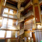
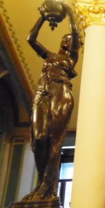 You may note that the newels at the foot of the Grand Stairway are a pair of female statues that might look familiar. Here’s the story. Iowa first commissioned them. They were considered too racy, so they were sold to Illinois. Later, uncomfortable with that decision, Des Moines commissioned replicas. The art is beautiful and an appropriate reproduction in bronze of a statue that was featured at the 1893 Columbian Exposition. It is titled Illinois Welcomes The World.
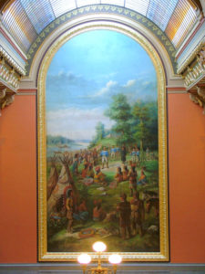
A giant painting, measuring 40 x 20 feet, depicts George Rogers Clark, leader of the Kentucky Long Knives, negotiating with Native Americans at Fort Kaskaskia. Therein lies another story (of course!). The Illinois Territory was inaugurated at Kaskaskia. On July 4, 1778, Clark and his band captured Kaskaskia from the British. Illinois became a western county of . . . Virginia! Clark was instrumental in securing the entire Northwest Territories during the American Revolution.
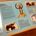
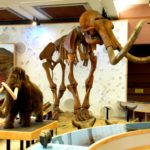
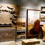
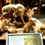
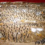
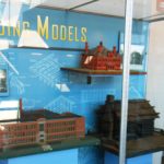
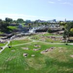
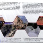
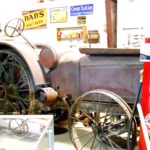
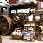
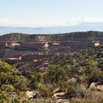
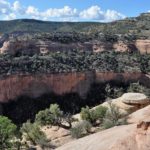
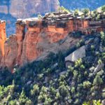
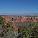
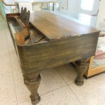
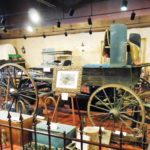
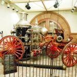
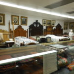
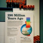
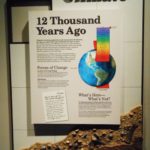
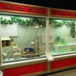
At the other end of the Capitol grounds was the State Museum. It held many fine exhibits. The feature of the week was geology, and I was met by an educator who would have spent an hour teaching me about fossils until I begged to move on. There were very comprehensive exhibits portraying Illinois through the ages — and prior to being Illinois. Other large exhibits explored industry and Native Americans. Another highlighted “contemporary” living. Snippets of several are displayed below.
-

-
Earth Calendar: All of History in 30 Days!
-
-
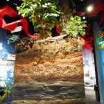
Slice of the Earth, showing the strata.
-
-
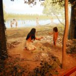
A look long ago…
-
-
…And somewhat more recently.
-
-
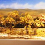
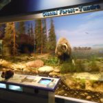
Environment: Glacial Tundra
-
-
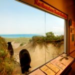
Environment: The Beach
-
-
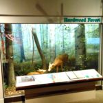
Environment: Hardwood Forest
-
-
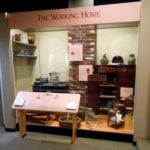
Side by Side: His and Her Roles
-
-
Side by Side: Home and Family
-

-
Side by Side: Things Get Easier
-
-
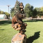
Early Residents
-
-
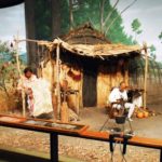
Early Residence
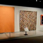
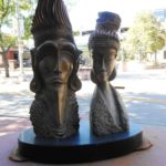
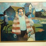
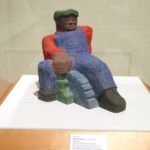
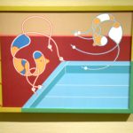
A temporary exhibit was a six-month presentation entitled Figurism. It’s not only an exhibit featuring 2D and 3D artwork but a series of lectures about the subject of figure art. I think the thing that most drew me to it is the fact that one of the artists is Mike Ferris, and Eleanor Speiss-Ferris is one of the lecturers! Wonder where they are on the family tree!
-
-
Untitled, Mike Ferris
-
-
Seated Worker, Artist Unknown
-
-
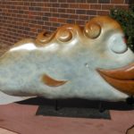
Day for Divers, Barbara Rossi
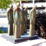
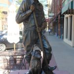
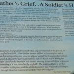
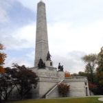
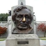
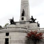
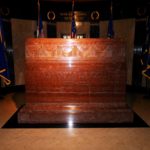
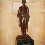
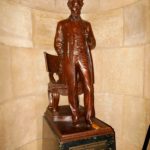
Our last city visit was to the Oak Ridge Cemetery, final resting place of The Lincoln Family. There was a holding facility in the cemetery for deceased whose graves were not ready. A Monument Association grew out of the Memorial Committee that planned his return to Springfield. Recognizing how long it would take to construct the President’s mausoleum, a separate building was erected to contain both Lincoln and the two sons who predeceased him. The family selected the site, and the Monument Committee raised the funds to erect the shrine. Ground was broken in 1869, and dedication ceremonies were held in 1874. At that time, three Lincoln sons and the president were interred. The Monument was subsequently rebuilt twice, in 1899-01 and the 1930s. The first added 15 feet to the spire and lowered the remains to an underground crypt. The second rebuilt the interior out of granite and marble, added the red marble memorial stone, and installed the interior statuary that depicts the multiple roles played by the Great Emancipator during his lifetime. Outside, there is a bust of Lincoln by Gutzon Borglum, sculptor of Mt. Rushmore, its nose polished to a bright gold from the hands of visitors seeking good luck. Around the base are statues of the four key military forces: Infantry, Cavalry, Artillery and Navy. The statues below are two of a dozen, about two-thirds life size, that rim the crypt.
-
-
The now-heightened tower
-
-
Borglun’s sculpture with its shiny nose
-
-
-
-
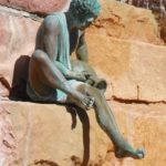
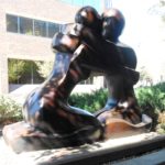
Lincoln the Soldier
-
-
Lincoln the Statesman
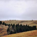
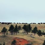
Oak Ridge contains the remains of many other important citizens, from early settlers to politicians to war heroes.
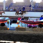
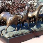
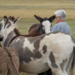
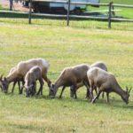
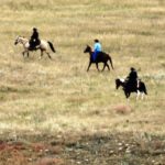
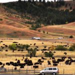
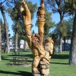
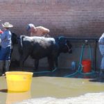
Horse Fair at the Fairgrounds
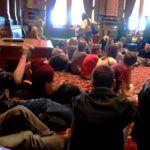
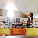
Our on-campus adventures were fun. The 30th Annual Youth Charity Horse Show offered a hundred or so events, all ranged by age from the littlest (who rode hobby horses!) to the seniors, who were mid-teens. It was polished and professional and brings in mid-five figure reward for its efforts.
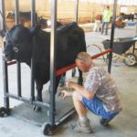
Dot went over on Wednesday evening to the Exhibitor Building to help Michele unload the mountain of stuff she had for sale at the Prairieland Classic, a cluster of eight separate all-breed specialty dog shows over a four day period. We both arrived early on Thursday to help the setup and cover for her when she was scheduled to be in the show rings.
We headed out on Friday morning, even though the heating system quit again. We were now heading south and hoped it didn’t matter!